The world of amateur radio continually evolves with technology, offering enthusiasts innovative tools for communication and data sharing. Among these, the Automatic Packet Reporting System (APRS) stands out as a powerful protocol enabling real-time location tracking and messaging. This article delves into the fundamentals of APRS, explores its practical applications for amateur radio operators, and provides insight into setting up and utilizing APRS effectively for both positioning and communication purposes.
- What Is APRS? An Overview of Automatic Packet Reporting System
- Core Components of APRS
- Fundamental Features of APRS
- 1. Real-Time Location Sharing
- 2. Text Messaging
- 3. Telemetry and Status Reporting
- Practical Applications of APRS in Amateur Radio
- Emergency Communications and Disaster Response
- Event Management and Public Service
- Outdoor Adventures and Personal Use
- Scientific and Environmental Monitoring
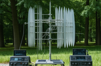
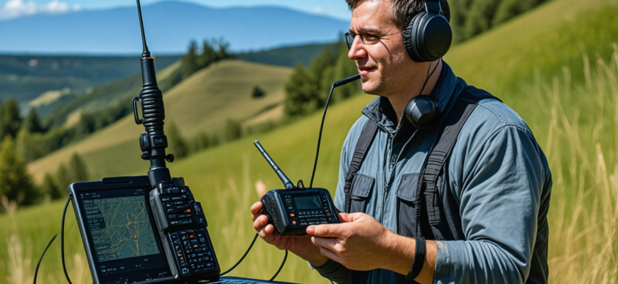
- Setting Up an APRS Station
- Hardware Requirements
- Software Setup
- Example Configuration Parameters
- Understanding APRS Data and Protocols
- Packet Format and Data Encoding
- Sample APRS Position Report
- Using Internet Gateways and Online Tools
- Benefits of Using APRS via Internet
- Advantages and Limitations of APRS
- Advantages
- Limitations
- Summary: Maximizing the Potential of APRS
- Future Trends and Developments
What Is APRS? An Overview of Automatic Packet Reporting System
Developed in the late 1980s by Bob Bruninga, WB4APR, APRS is a digital communication protocol tailored for real-time exchange of location, status, and short messages over amateur radio networks. It functions as an overlay atop existing radio channels, allowing a multitude of devices—such as mobile stations, fixed stations, and portable units—to share and receive data seamlessly.
Core Components of APRS
- Hardware: Radio transceivers compatible with VHF/UHF frequencies, GPS receivers, and computer interface units.
- Software: APRS-enabled applications such as UI-View, AprsIS, or open-source options like Xastir and APRSdroid.
- Network Infrastructure: RF digipeaters and internet gateways (IGates) that relay APRS data between radio and internet networks.
Fundamental Features of APRS
1. Real-Time Location Sharing
APRS transmits your GPS coordinates periodically, allowing others to see your precise position in real-time via maps on web portals or APRS client software. This feature is invaluable during emergency services, outdoor expeditions, and public events.
2. Text Messaging
Beyond location, APRS supports short text messages, enabling communication between stations without traditional voice channels. This messaging capability enhances coordination efforts, especially in emergency or remote scenarios.
3. Telemetry and Status Reporting
Operators can configure APRS to send telemetry data such as battery levels, temperatures, or sensor readings, facilitating remote monitoring of equipment or environmental conditions.
Practical Applications of APRS in Amateur Radio
Emergency Communications and Disaster Response
During emergencies, traditional communication infrastructure may fail. APRS provides a resilient network for tracking rescue teams, transmitting situational data, and coordinating efforts. Its real-time tracking features enable operators to visualize the positions of responders and assets on a shared map, greatly enhancing situational awareness.
Event Management and Public Service
At large gatherings, such as marathons or festivals, APRS facilitates the management of personnel, vehicles, and equipment. Organizers can track locations, communicate quickly, and maintain coordination among various teams.
Outdoor Adventures and Personal Use
Hikers, climbers, and outdoor enthusiasts leverage APRS to share their position with friends and family, improving safety. Many portable radios with GPS modules allow for easy integration with APRS, providing live updates of their whereabouts.
Scientific and Environmental Monitoring
Researchers use APRS to transmit sensor data in real-time from remote locations, helping monitor environmental variables like weather conditions, pollution levels, or wildlife movements.
Setting Up an APRS Station
Getting started with APRS involves several steps, including selecting proper hardware, installing software, and establishing network connections. The complexity varies depending on intended use—whether mobile, fixed, or portable.
Hardware Requirements
- Radio Transceiver: 2-meter (VHF) or 70-centimeter (UHF) radios configured for APRS frequencies (typically 144.390 MHz in North America).
- GPS Receiver: For accurate positioning data, most stations include a GPS module connected via serial or USB interfaces.
- Computer or Raspberry Pi: Running APRS software, interfaced with radio and GPS units.
Software Setup
- Choose a suitable APRS client compatible with your operating system (Windows, Linux, Android).
- Configure radio parameters, GPS data input, and network options.
- Set up or connect to an IGate for internet access, enabling broader data dissemination.
Example Configuration Parameters
| Parameter | Example Value |
|---|---|
| Radio Frequency | 144.390 MHz |
| Callsign | AB1CD-9 |
| SSID | -9 (for mobile station) |
| GPS Baud Rate | 4800 bps |
| Station Location | Latitude/Longitude coordinates |
Understanding APRS Data and Protocols
Packet Format and Data Encoding
APRS packets adhere to a structured format to encode position, messaging, and telemetry data efficiently. Each packet contains a header with callsign, position, course, speed, timestamp, and optional message fields.
Sample APRS Position Report
!AB1CD-9>APRS,TCPIP*:*4713.02N/09407.45W> Course: 180° Speed: 30 knots • Time: 2024-04-27 14:30
Using Internet Gateways and Online Tools
APRS data shared over RF can be relayed to internet servers via IGates, expanding the reach of each station. Several online platforms visualize APRS data globally, including:
- APRS.fi
- APRS2.net Map
- Various mobile applications that display live APRS data
Benefits of Using APRS via Internet
- Global visibility of station positions
- Ease of monitoring multiple stations using web interfaces
- Enhanced reliability and redundancy
Advantages and Limitations of APRS
Advantages
- Provides real-time location data with minimal latency
- Lightweight communication suitable for low-bandwidth channels
- Supports diverse data types: position, messages, telemetry
- Widely adopted and supported in the amateur radio community
Limitations
- Range depends heavily on radio coverage and propagation conditions
- Requires compatible hardware and some technical knowledge
- Limited data bandwidth restricts complex messaging or high-frequency updates
- Potential interference and congestion in crowded radio environments
Summary: Maximizing the Potential of APRS
APRS remains a versatile and invaluable tool for amateur radio operators interested in real-time tracking and messaging. Its ability to integrate GPS data with radio communications opens diverse opportunities for safety, event coordination, scientific research, and personal use. Proper understanding of hardware setup, software configuration, and network integration is crucial for harnessing its full capabilities.
Future Trends and Developments
- Integration with mobile apps for simplified operation
- Enhanced telemetry with sensor data collection
- Use of digital modes like APRS-IS for improved reliability
- Increased use of internet gateways for seamless worldwide coverage
In the evolving landscape of amateur radio, APRS stands as a cornerstone protocol that bridges traditional RF communication with modern internet-enabled tracking and messaging. Its ability to provide real-time positional data, facilitate quick messaging, and support telemetry makes it an essential tool for radio enthusiasts committed to safety, research, and community engagement. As technology advances, APRS’s role is poised to grow, offering even more robust and user-friendly solutions for the amateur radio community worldwide.
Похожие записи:
 Ultimate Guide: Best Practices for Setting Up a Remote Radio Station Accessible Worldwide
  Emergency Communication Protocols for Ham Radio Operators: The Latest Updates and Best Practices
  Integrating Internet-Linked Repeater Systems with Traditional Ham Gear: A Comprehensive Guide
  Effective Tips for Organizing Successful Ham Radio Contests: A Comprehensive Guide
  Comprehensive Review of the Latest Transceiver Models on the Market: Innovations and Performance for Amateur Radio Enthusiasts
  Effective Troubleshooting Guide for Common Radio Hardware Issues in Amateur Radio
  New Regulations Affecting Amateur Radio Licensing and Operation: What You Need to Know
  How to Build Your Own Homemade QRP Transceiver: A Comprehensive Guide for Amateur Radio Enthusiasts
  Innovative Antenna Designs for Enhanced HF Performance
  Advances in Battery Technology for Portable Ham Radio Use: Powering the Future of Amateur Radio
  Последние достижения в области цифровых средств связи в любительском радио: инновации и будущее